All posts by Peter Tuckwell

Wollemi NP: Budgary Creek – River Cave Canyon circuit

Several days were spent closely checking the changing forecasts and the recorded rainfall at Lithgow, Clarence and Glen Davis. Very little rain was recorded at Clarence since Wednesday and with a 50% chance of 1mm forecast, our walk went ahead with a final plan of “take a look” at the canyon before proceeding.

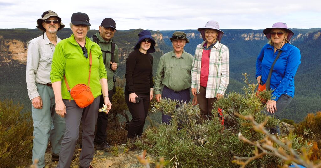
Nine walkers including 3 visitors, enjoyed a day in Wollemi National Park, somehow avoiding what the changing weather threw at us. Meeting at Clarence at 8:15am, Peter advised of Plan A (as advertised), Plan B (skip the canyon and do a full loop of Deep Pass from North to South), Plan C (a repeat of the 24th May 2024 walk) and Plan D (Mt Irvine and The Tessellated Pavements).

We thought the intermittent rain still falling as we drove along the dirt road, would keep us out of the canyon, so we considered swapping the two sections of the walk by doing Deep Pass first (Plan A-1) so we had a better chance doing the canyon in the afternoon.

However, Peter’s driving navigational error took us to the start of the Canyon and the northern entrance to Deep Pass, thus missing our car shuffle finish point at the western entrance to Deep Pass. That 400m section of road missing on google maps has a lot to answer for!

No problem, let’s do the canyon first and then Deep Pass as a ‘down and back’ after that (Plan A-2) so there would then be no need for a car shuffle!

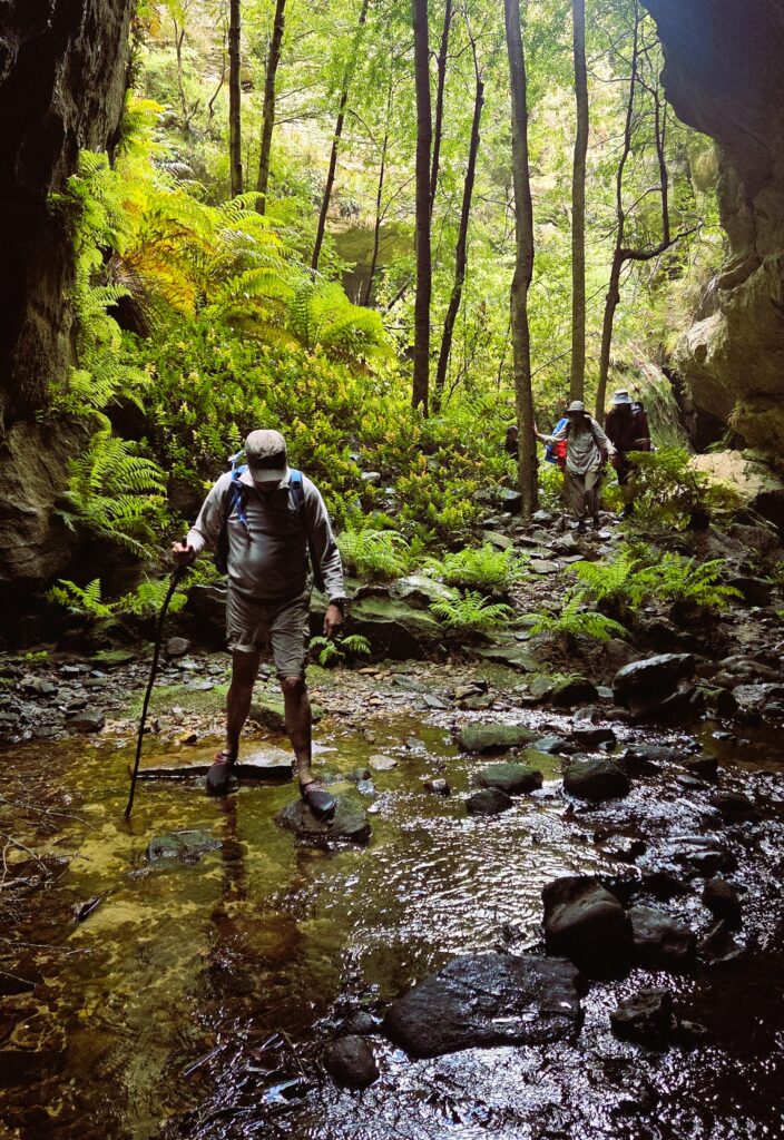
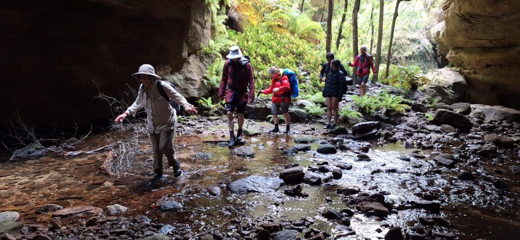
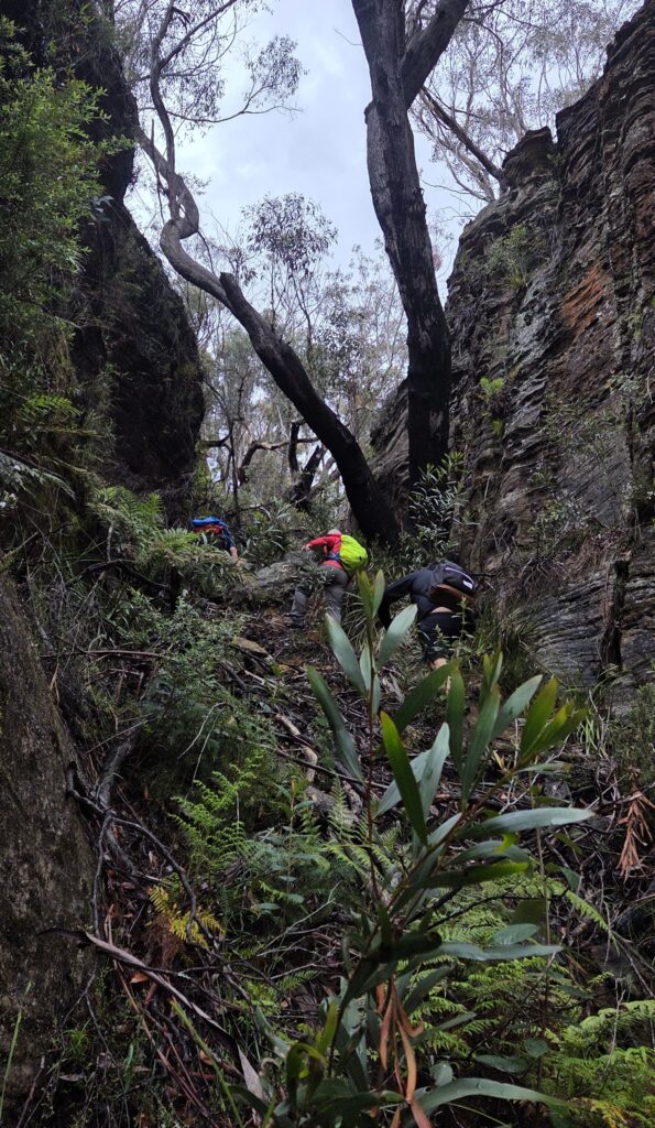
As we descended the track and side creeks towards Budgary Creek (anti-clockwise circuit), ‘baby’ hail falling on us for a minute, was a surprise as we sloshed through very wet and thick scrub descending towards River Cave Canyon.

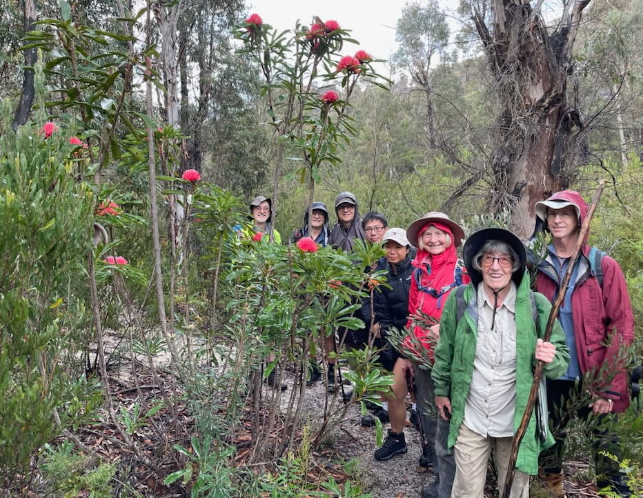
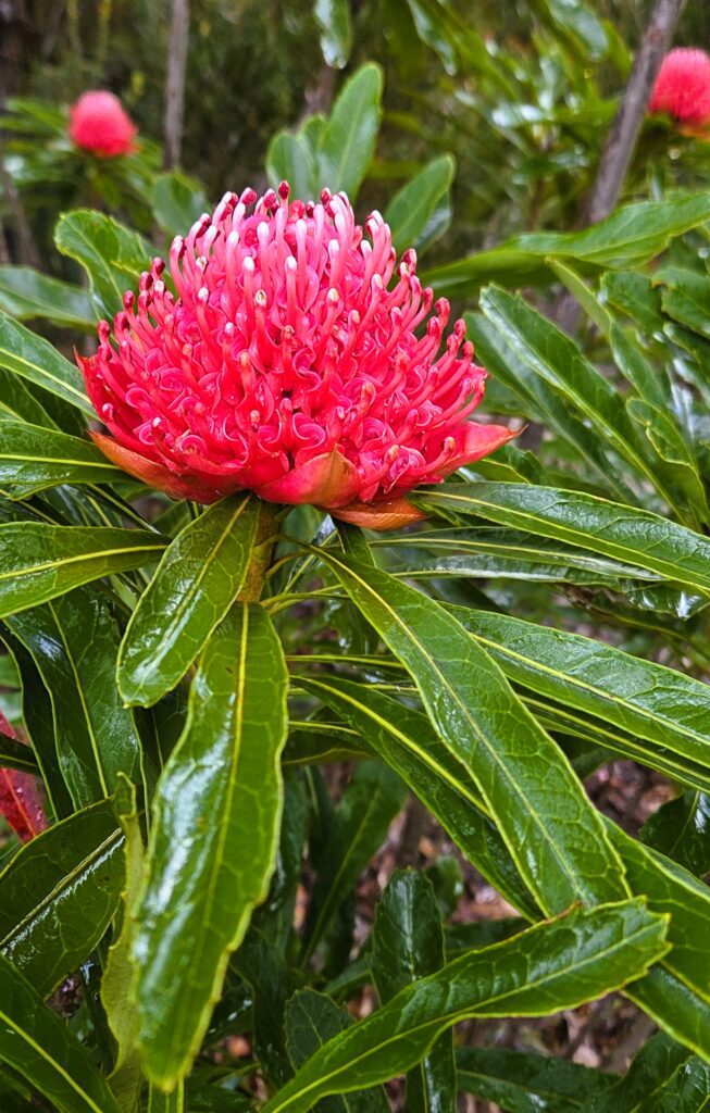
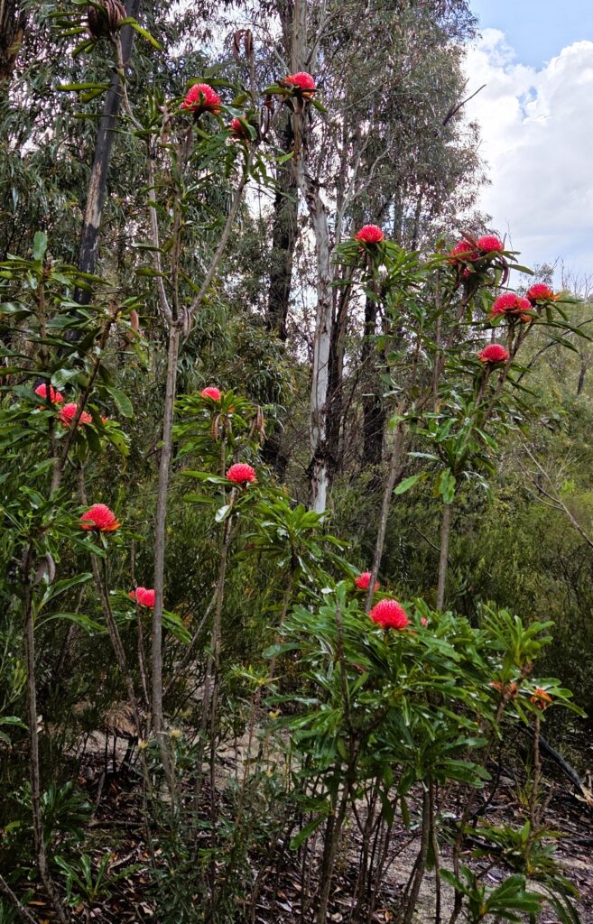
Waratahs were everywhere on the way down and later on the way up. They had really come out over the prior 3 weeks. Masses of other flowers also delighted.

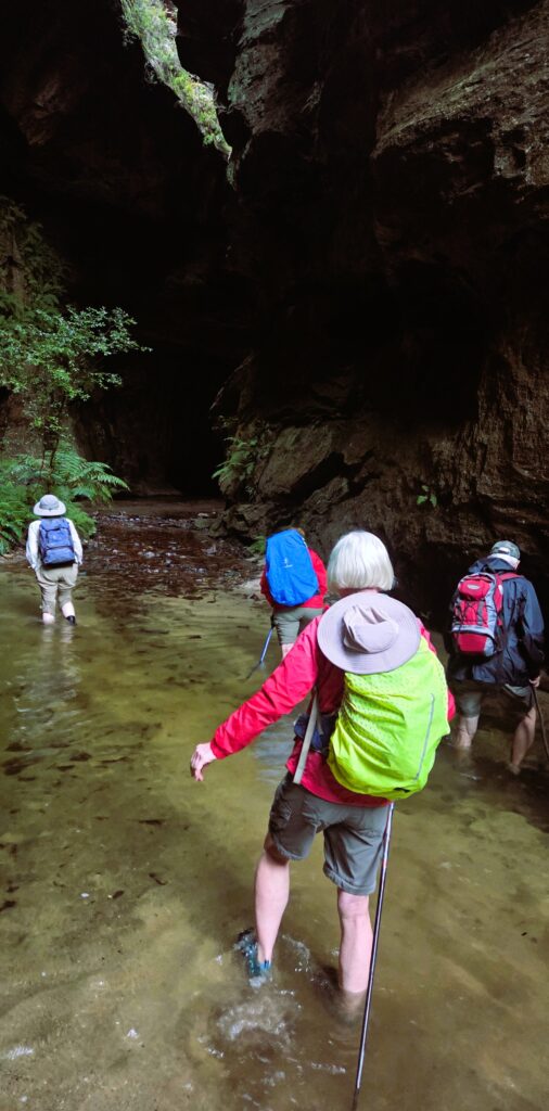
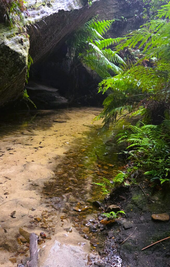
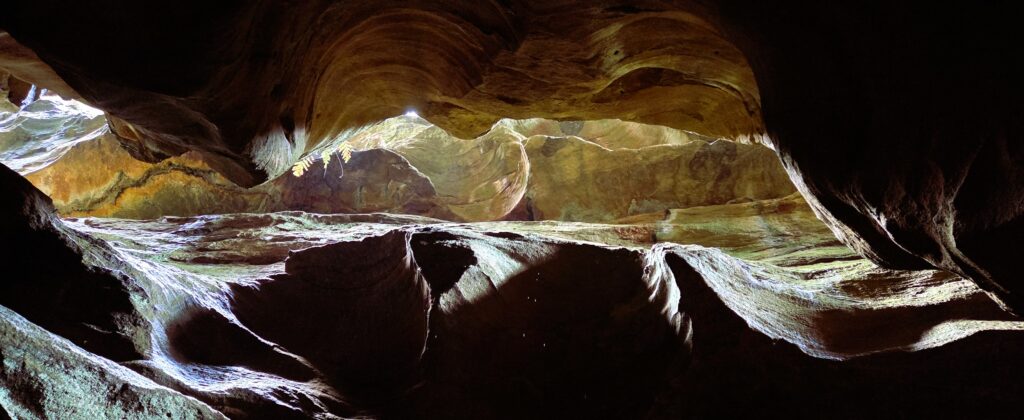
The odd shower and thunder tried hard to put us off continuing but luckily we found no change in the creek level compared to our recce 3 weeks earlier, so a fantastic explore awaited us.

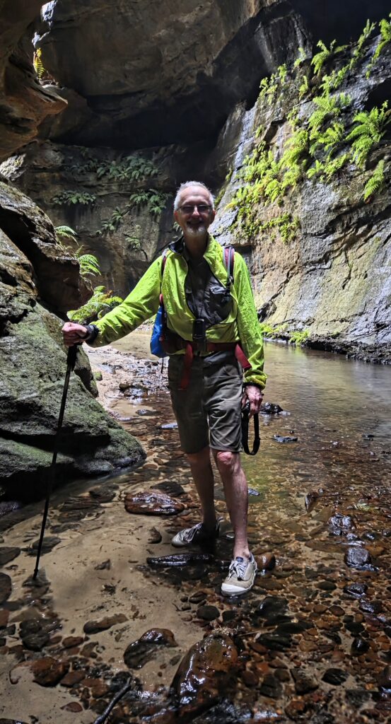
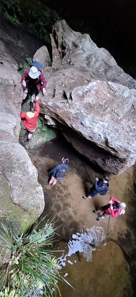
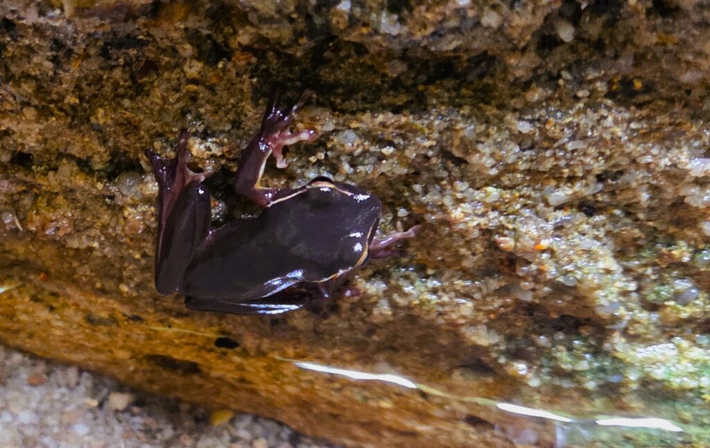
Changed into “wet” shoes, the Canyon did not disappoint. Taking our time, we looked at every angle as we splashed along in ankle to thigh deep water. The little climb up and along a rock platform avoided the deep pool, was no problem. Connie and Johnny (2 of our visitors) were well prepared, young and quite agile, so no problem on this walk as was Hazel from HVB, our other club. Julie spotted a lovely small black frog just before the end of the canyon. After videos and many photos were taken, we eventually reached the steep, rough climb up between the rock walls. It was not long before we reached the road and our cars.

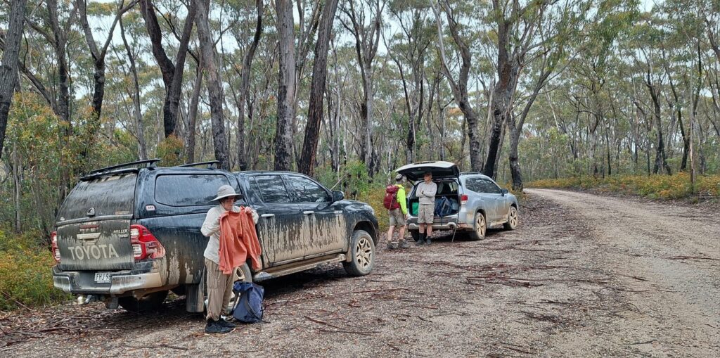
On return, we hid from increased falling rain, eating lunch in the cars. It was now time that a final plan (Plan E) was hatched. Most agreed, it would be pointless and not much fun walking in this drizzle and the roads would be getting more hazardous if left later to negotiate, so….. “Nar, let’s give it a miss!”

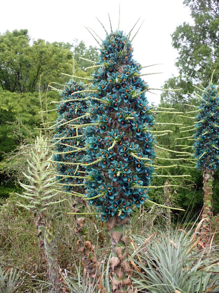
Coffee and cake at Mt. Tomah Botanic Gardens sounded so much nicer, so off we headed.

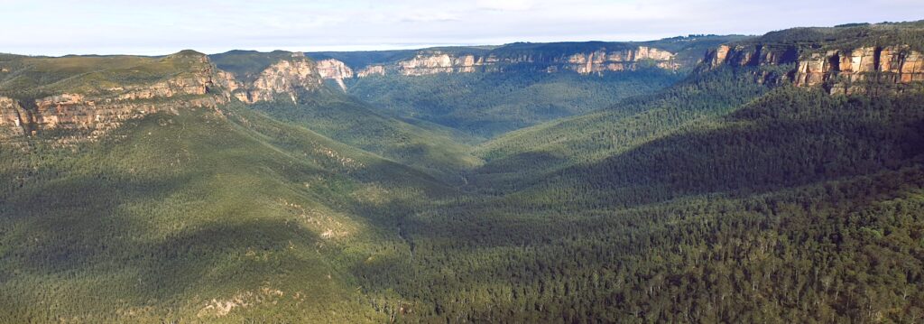
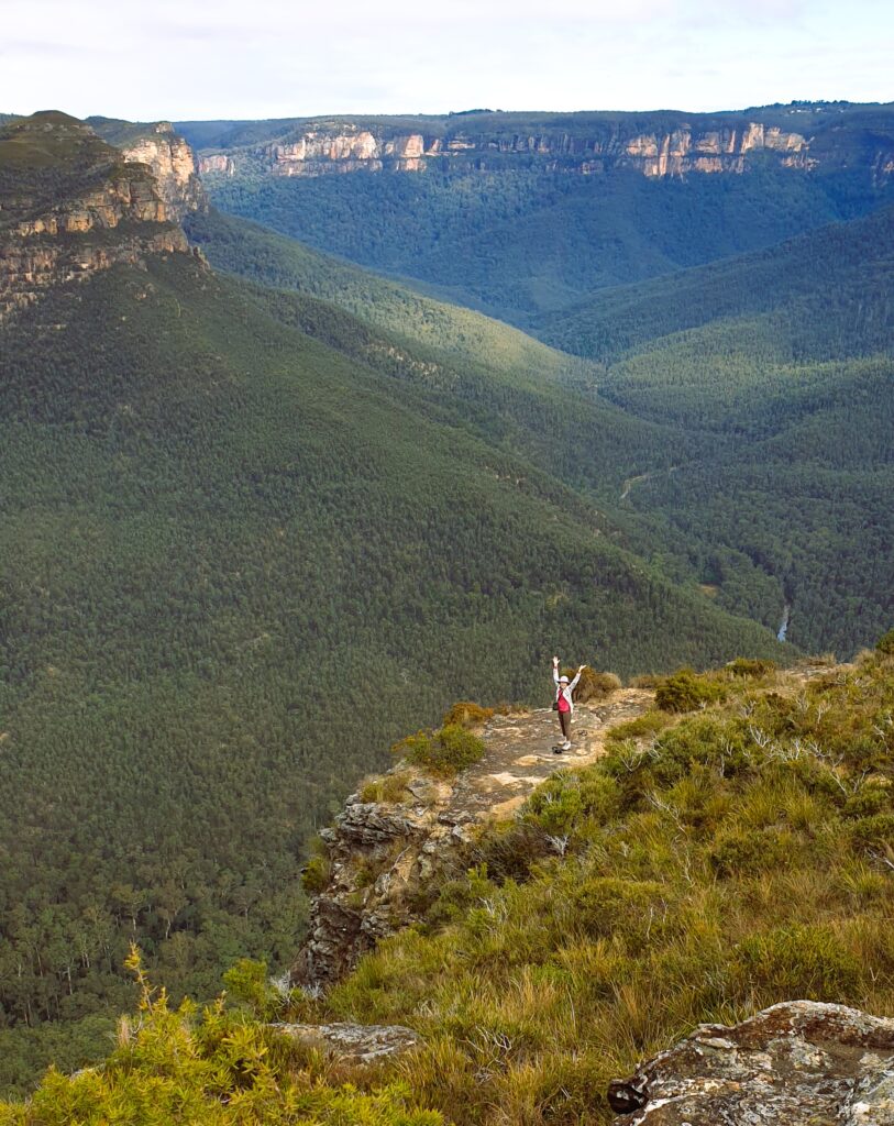
It was still raining when we got there, making the view across the gardens and valleys spectacular.

After coffee, some viewed a fancy displayed flower (name?) just below the centre.

In summary, we dodged a bullet and had a lovely time in the canyon, thus making the most of our day.

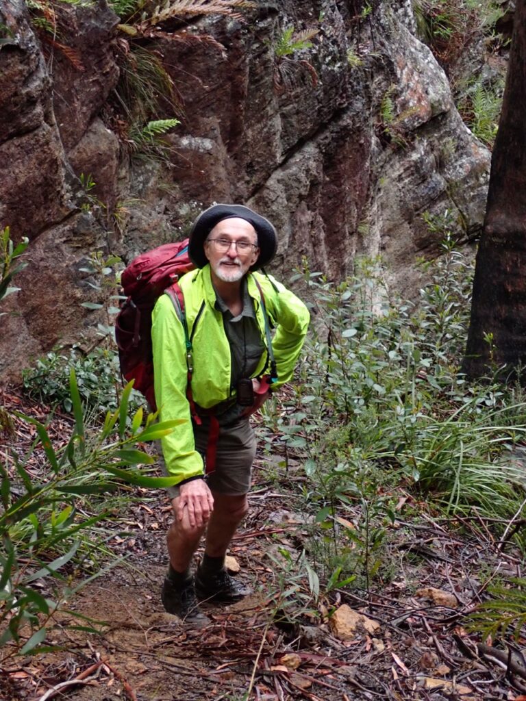
Walkers: Gary, Julie, Loïc, Fernando, Hazel (V), Connie (V), Johnny (V), Jenny and Peter.

Photos: https://photos.app.goo.gl/8kkENkh6h5oZBXxz9

Video of a segment of the canyon: https://youtube.com/shorts/lpo33dr0-F4

Group on our way into River Cave Canyon - Julie taking photo
Group on our way into the canyon (Julie taking photo)
Waratahs were everywhere as we descended the track
Masses of Waratah
Entering the canyon
a lovely cool place.. and the sun came out!
getting a little deep in places
Peter posing
Julie is up to something?
Loïc being followed
our little climb within the canyon-Photo: Fernando
A nice canyon to transit
Looking up was spectacular
Julie spotted this lovely little frog just before we exited the canyon
Peter climbing out of canyon
A steep and rough bit of track for our exit. Photo: Fernando
Back at the cars…. “Mud, mud, glorious mud… there’s nothing quite like it for cooling the blood” Photo: Fernando
Puya alpestris at Mt. Tomah Gardens – Photo Hazel

Mt Banks Extended One Trail Loop

Sat 28th June 2025 Mt Banks Extended One Trail Loop

Looking south along the Gross River towards Blackheath form lookout

With a brisk start to the day at 5 degrees, 7 walkers arrived around 8am for what turned out to be a very nice day, starting with sunshine but clouding over a little bit by morning tea.

Climbing about 250m up the trail on the north side of Mt. Banks from the carpark was our first challenge. At least 2 stops to remove clothing were needed. Stopping at our 1st lookout offered excellent views to our west. Once at the Mt. Banks summit, more fantastic views offered us a clear view south to the Gross River, Blue Gum Forest, Perrys Lookdown, Junction Rock and Govetts Leap Falls, and to our west, the valley leading to Mt. Victoria. Descending the south east track back to the fire trail was an easier. Now continuing south for 2.2km along the fire trail, we reached a great lookout along Banks Wall for morning tea. Another 250m brought us to our first off-track route to Frank Hurley Head. This ridge was easy to navigate via mostly low plants including some lovely small Banksia species about 1 foot high. Wattles were in full bloom in many areas. The lookout at to Frank Hurley Head offered views extending further to our south and south east, downstream along the Gross River. We speculated which outcrop was Lockley Pylon as its appearance was different from the north. Looking now at the map, it was likely obscured by Du Faur Head. Returning via a shorter off-track route, we returned to the fire trail to continue another 180m before our next off-track route to our 2nd unnamed headland and lookout. From hear we could peer down into a deep ravine to our east with spectacular vertical cliffs on the other side. After a group photo taken, we now returned via the fire trail that leads to this headland, back to the main fire trail. We quickly realised that this was the end of clear fire trail as we now pushed through overgrown shrubbery along this Explorers Range track to our east. Our aim was to reach Edgeworth David Head for lunch. Finding a suitable exit, we navigated our third off-track route uphill through quite dense bush. It opened up for a while until we reached the first summit but it then got denser for what would have been the last 200m. We aborted this attempt, turning to our west to find an alternate lunch spot. An open grassy patch with views to our west was fine for lunch. Returning downhill to the overgrown fire trail, we quickly returned to the car park over this 6.5km section of this 14.7km walk.
Drinks in the sun at the Archibald Hotel at Kurrajong Heights rounded off a great day.

Walkers: Peter, Justin, Wendy C, Wendy LR, Jas, Annemarie, Karina

Peter’s Photos: https://photos.app.goo.gl/KKbxFgZk9PBpEgDp8

Group looking south west towards Blackheath with Gross River below
Wendy on top of the world – looking south along Gross River towards Blackheath