Mt Banks Extended One Trail Loop
Sat 28th June 2025 Mt Banks Extended One Trail Loop
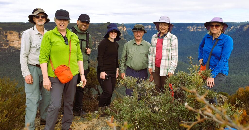
With a brisk start to the day at 5 degrees, 7 walkers arrived around 8am for what turned out to be a very nice day, starting with sunshine but clouding over a little bit by morning tea.
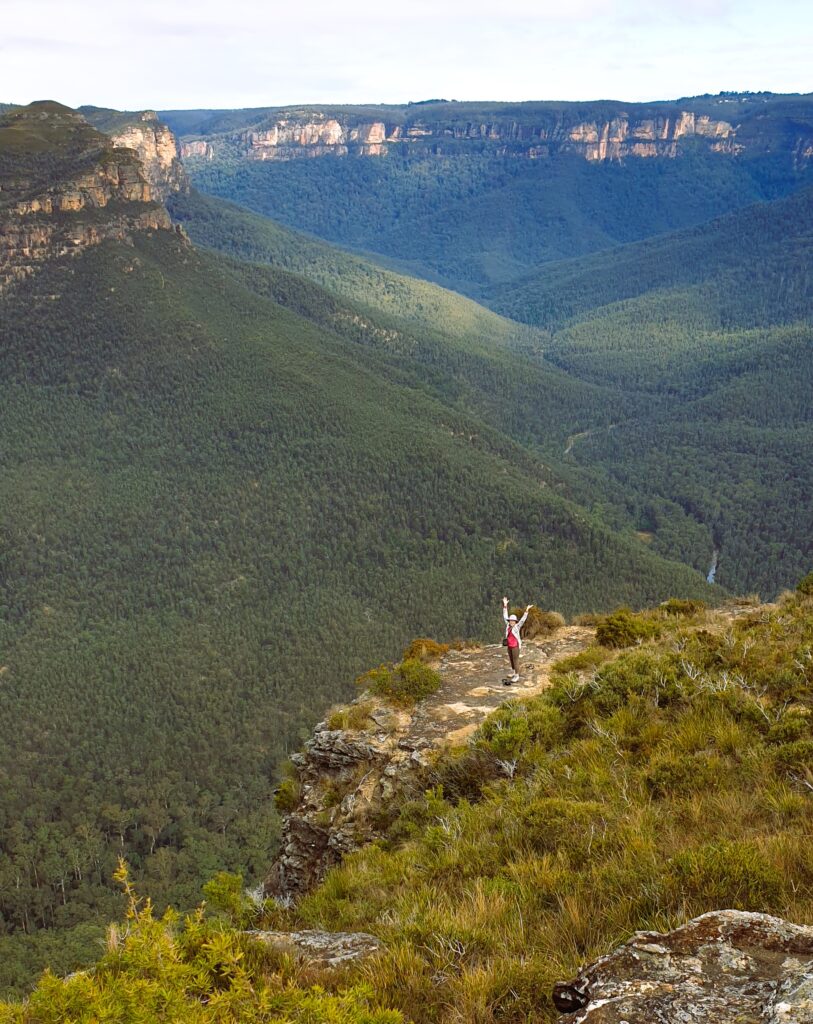
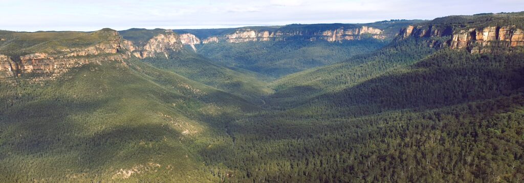
Climbing about 250m up the trail on the north side of Mt. Banks from the carpark was our first challenge. At least 2 stops to remove clothing were needed. Stopping at our 1st lookout offered excellent views to our west. Once at the Mt. Banks summit, more fantastic views offered us a clear view south to the Gross River, Blue Gum Forest, Perrys Lookdown, Junction Rock and Govetts Leap Falls, and to our west, the valley leading to Mt. Victoria. Descending the south east track back to the fire trail was an easier. Now continuing south for 2.2km along the fire trail, we reached a great lookout along Banks Wall for morning tea. Another 250m brought us to our first off-track route to Frank Hurley Head. This ridge was easy to navigate via mostly low plants including some lovely small Banksia species about 1 foot high. Wattles were in full bloom in many areas. The lookout at to Frank Hurley Head offered views extending further to our south and south east, downstream along the Gross River. We speculated which outcrop was Lockley Pylon as its appearance was different from the north. Looking now at the map, it was likely obscured by Du Faur Head. Returning via a shorter off-track route, we returned to the fire trail to continue another 180m before our next off-track route to our 2nd unnamed headland and lookout. From hear we could peer down into a deep ravine to our east with spectacular vertical cliffs on the other side. After a group photo taken, we now returned via the fire trail that leads to this headland, back to the main fire trail. We quickly realised that this was the end of clear fire trail as we now pushed through overgrown shrubbery along this Explorers Range track to our east. Our aim was to reach Edgeworth David Head for lunch. Finding a suitable exit, we navigated our third off-track route uphill through quite dense bush. It opened up for a while until we reached the first summit but it then got denser for what would have been the last 200m. We aborted this attempt, turning to our west to find an alternate lunch spot. An open grassy patch with views to our west was fine for lunch. Returning downhill to the overgrown fire trail, we quickly returned to the car park over this 6.5km section of this 14.7km walk.
Drinks in the sun at the Archibald Hotel at Kurrajong Heights rounded off a great day.
Walkers: Peter, Justin, Wendy C, Wendy LR, Jas, Annemarie, Karina
Peter’s Photos: https://photos.app.goo.gl/KKbxFgZk9PBpEgDp8